The Aerial Triangulation process can be accomplished easily for all kind of aerial sensors (both analogy and digital) and also for satellite imagery. Using GPS/INS accurate data, the number of GCPs during the Survey Missions can be considerably reduced by using the latest state of the art software and this technic is known as Integrated Sensor Orientation ( that involve a data bundle adjustment for an aerial triangulation block).
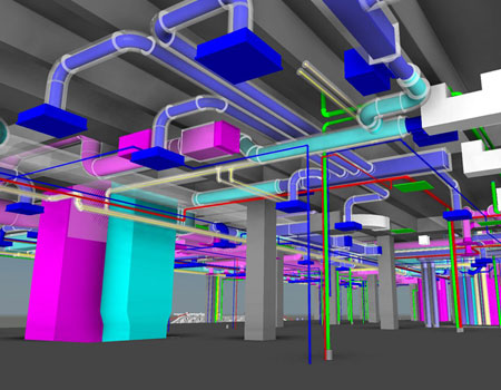
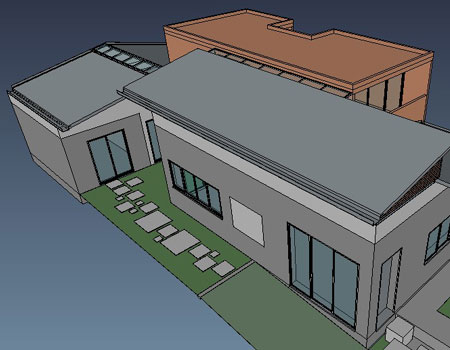
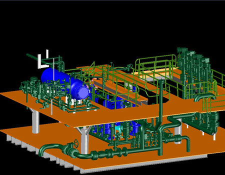
BIM or Building Information Modelling is a process for creating and managing information on a construction project across the project lifecycle. One of the key outputs of this process is the Building Information Model, the digital description of every aspect of the built asset. This model draws on information assembled collaboratively and updated at key stages of a project. Creating a digital Building Information Model enables those who interact with the building to optimize their actions, resulting in a greater whole life value for the asset.