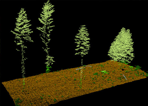
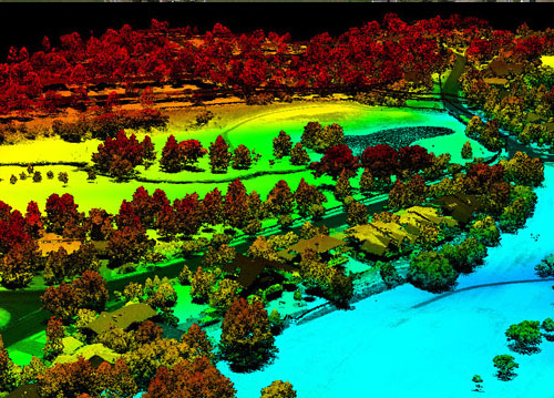
LiDAR technology

LiDAR, or light detection and ranging, is a popular remote sensing method used for measuring the exact distance of an object on the earth’s surface.
Types of LiDAR Systems

LiDAR systems are divided into two types based on its functionality — Airborne LiDAR & Terrestrial LiDAR.

Airborne LiDAR
Airborne LiDAR is installed on a helicopter or drone for collecting data. As soon as it’s activated, Airborne LiDAR emits light towards the ground surface, which returns to the sensor immediately after hitting the object, giving an exact measurement of its distance. Airborne LiDAR is further divided into two types — Topological LiDAR and Bathymetric LiDAR.
Terrestrial LiDAR
Unlike Airborne, Terrestrial LiDAR systems are installed on moving vehicles or tripods on the earth surface for collecting accurate data points. These are quite common for observing highways, analysing infrastructure or even collecting point clouds from the inside and outside of buildings. Terrestrial LiDAR systems have two types — Mobile LiDAR and Static LiDAR.
WhatsApp WhatsApp us