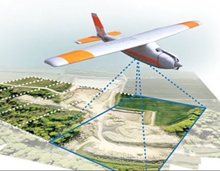
Stereo Mapping is the process of capturing 3D features from stereo aerial photos. Available for all sorts of platforms, to enable you to work in your software of choice.
Stereo Analyst for ERDAS IMAGINE
Stereo Analyst for ERDAS IMAGINE is a user-friendly aid to capture 3D objects using stereo viewing. It transforms your 2D GIS to its proper dimensions by capturing 3D geographic information, directly from the raw images. As a module on top of ERDAS IMAGINE and IMAGINE Photogrammetry (formerly: LPS), Stereo Analyst for ERDAS IMAGINE can run within both environments, without additional third-party software. By enabling capturing 3D objects using easy to use tools, Stereo Analyst for IMAGINE offers fast access to 3D analyses. Use the 3D information to make your GIS data more accurate, and to perform mission critical analyses, including land use, land cover and infrastructure management. Using Stereo Analyst for ERDAS IMAGINE users can apply textures to buildings in their 3D models, creating next to real visualizations of built up areas.
Stereo Analyst for ArcGIS
Using Stereo Analyst for ArcGIS you can develop and maintain extended databases containing feature data. Stereo visualization offers a better interpretation of imagery, and it allows users to capture geometry more precise as in ortho images. Since Stereo Analyst was built in ArcObjects, and since it is closely interlinked with ArcGIS, you can do your stereo capturing within the environment you already know and like. Because of the transparent integration within the ArcGIS platform, Stereo Analyst expands the visualisation capabilities of ArcGIS, while ArcGIS offers all its analysis tools to the workflow. Because users can experience the terrain in three dimensions, Stereo Analyst for ArcGIS also offers the capability to interpret the topological features more effectively.
PRO600 for MicroStation
PRO600 is an extension to the Bentley MicroStation and Bentley Map (stand alone and Enterprise), to enhance its ability to be used in large mapping projects. Using stereo images the tools of PRO600 can extract all sorts of 3D features from images. workflows. PRO600 is built up from two modules: PROCART and PRODTM. These modules can be used individually or combined. Detailed feature capturing takes place in the PROCART module. The PRO600 PRODTM module integrates terrain editing, and it contains an extensive toolset for all sorts of mapping projects. With a strong history in reliable quality editing, PRO600 is a proven solution that has been applied all over the world.
TIN
The TIN model represents a surface as a set of contiguous, non-overlapping triangles. Within each triangle the surface is represented by a plane. The triangles are made from a set of points called mass points. Mass points can occur at any location, the more carefully selected, the more accurate the model of the surface. Well-placed mass points occur where there is a major change in the shape of the surface, for example, at the peak of a mountain, the floor of a valley, or at the edge (top and bottom) of cliffs. The TIN model is attractive because of its simplicity and economy and is a significant alternative to the regular raster of the GRID model.Tunnel
Precise modeling of tunnel structures can be used to evaluate the performance and state of safety as an important construction analysis object. However, the problem of modeling on a large-scale tunnel is challenging, due to the poor-quality of the input data that is contaminated with severe missing areas, noise, outliers and the accessories. This work introduces the concept of hierarchical modeling to automatically derive a measured and accurate representation of a 3D shield tunnel. Our key observation is that the shield tunnel is composed of a certain number of segment pieces arranged in some designed patterns. We hereby apply hierarchical segmentation and element extraction, based on designed patterns, to intensity images without expensive computation. According to the corresponding relationship between the point cloud and the image, the segment pieces within the point cloud are extracted.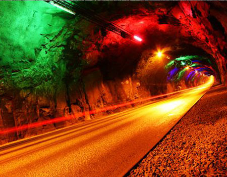
Therefore, we construct the corresponding 3D models of the segment pieces to obtain the precise structure model of the tunnel. As a result, segment pieces are extracted robustly, even in the presence of noise and large occlusion. Quantitative and qualitative comparisons of the proposed algorithm are presented with state-of-the-art methods. We evaluate the modeling method on a variety of raw LiDAR scans, in terms of its robustness and accuracy. Moreover, our method has been successfully applied in a number of practical projects to discover the multi-level structures of the shield tunnels, which are used to evaluate the safety state of tunnels.